
NE ENVIRONMENT BUREAU
CHENNAI, JAN 17
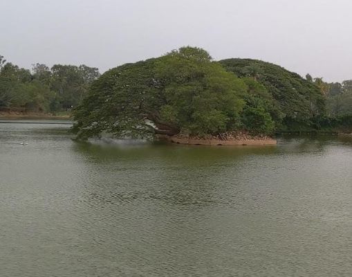
In a breakthrough for climate science and environmental planning in peninsular India, researchers have uncovered one of the most detailed long-term climate records ever documented from inland Tamil Nadu, extracted from sediments beneath the modest Kondagai Lake near Sivaganga. The findings offer rare insights into monsoon variability, ecosystem dynamics and human–environment interactions spanning nearly 4,500 years.
- High-resolution climate record unearthed from Kondagai Lake near Keeladi
- Study reveals ancient droughts, floods and ecosystem shifts shaping human settlements
- Findings offer a scientific roadmap for water security, biodiversity and disaster planning
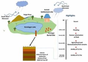
Tamil Nadu, despite its sensitivity to the Northeast Monsoon, has lacked well-dated, multiproxy lake records. Recognising this critical gap, scientists turned to Kondagai Lake, located close to Keeladi—an archaeological site that has transformed understanding of Tamil civilisation by revealing evidence of an advanced urban culture dating back to the Sangam era, possibly as early as the 6th century BCE. The lake’s location within ancient settlement zones made it an ideal natural archive to decode past climate behaviour and its influence on ecosystems and habitation.
The research team from the Birbal Sahni Institute of Palaeosciences, an autonomous institution under the Department of Science and Technology, excavated a sediment profile just over one metre deep. Thirty-two closely spaced samples were collected, each representing a distinct time slice. Using an advanced suite of techniques—including stable isotope analysis, pollen studies, grain-size analysis and radiocarbon dating—the team reconstructed past rainfall patterns, vegetation changes, lake levels and flood events with exceptional precision.
Published in the journal Holocene, the study presents the first high-resolution, multiproxy reconstruction of Late Holocene climate and lake-ecosystem dynamics from inland Tamil Nadu. It identifies three major climatic phases over the past 4,500 years: the 4.2 ka arid event, the 3.2 ka dry phase, and the Roman Warm Period. These phases were directly linked to shifts in monsoon intensity, lake hydrology and patterns of human activity in the region.
By mapping nearly five millennia of monsoon behaviour, the research establishes a long-term climatic baseline that can significantly strengthen regional climate forecasting. This historical perspective is vital for anticipating future droughts, extreme rainfall events and floods in one of India’s most climate-sensitive regions.
The findings also carry immediate relevance for water resource management in drought-prone districts such as Sivaganga and Madurai. Insights into historical lake-level fluctuations, sediment influx and hydrological changes can inform sustainable reservoir restoration, groundwater recharge strategies, tank rehabilitation and climate-smart agricultural water use—critical for communities dependent on monsoon-fed systems.
From a disaster-risk perspective, the identification of ancient flood deposits, phases of land destabilisation and terrestrial sediment influx contributes to more accurate risk mapping. These signals can help authorities identify zones vulnerable to flooding, channel migration and land degradation across the Vaigai river basin.
The study further strengthens archaeological and cultural heritage research. Kondagai Lake’s environmental history provides a contextual framework to understand how ancient societies near Keeladi adapted to climate stress, water scarcity and ecological change, enhancing interpretations of past human resilience and supporting informed heritage conservation.
Ecologically, the research offers a scientific foundation for wetland and lake restoration efforts. By documenting long-term changes in aquatic productivity, oxygen conditions and organic matter sources, the study enables evidence-based conservation planning and biodiversity strategies tailored to the region’s natural history.